Thinking Digitally About Forests: Opportunities and Solutions for Modern Forestry

As in many other areas of the economy and daily life, digitalization is also making its way into the forestry sector, fundamentally transforming processes, decision-making pathways, and workflows. Against the backdrop of climate change and increasing demands for efficiency, sustainability, and transparency, it opens up new possibilities: Forests can be analyzed using data, work processes can be optimized, and decisions can be made with greater confidence throughout the entire value chain. Terms such as Forestry 4.0, Forest 4.0, or Smart Forestry refer to the use of digital technologies in modern forestry.
With the central theme of “Digitalization in Forestry & Wood,” INTERFORST serves as a key platform for information, exchange, and innovation—both in its supporting program and among exhibitors representing various product groups.
Data as the Foundation of Digital Forestry
Data forms the foundation of digital forestry by making the forest measurable and analyzable in real time. High-resolution aerial images, precise satellite and terrain data, and machine-generated information provide transparent insight into the forest. Tools such as modern geographic information systems (GIS), drones, and sensor technology enable data collection, while artificial intelligence (AI) handles the analysis of forest and environmental data. As a result, foresters today have access to comprehensive information on the stand, site, and ecological and economic parameters of their forests. Digital data is now used in nearly all areas of forest management to make work more efficient and sustainable and to connect work processes and stakeholders: forest management planning, logging & tending, nature conservation & biodiversity, climate adaptation, and reporting & monitoring.
Equipment and systems for analysis and measurement
Today, innovative technologies have made the analysis and surveying of forests significantly easier. In addition to traditional methods, digital systems are increasingly being used, such as GPS-assisted surveying, geographic information systems (GIS), satellite imagery, and drones equipped with high-resolution cameras or laser scanners. LiDAR technology (laser scanning), in particular, enables the precise three-dimensional mapping of forest areas, terrain features, and tree heights, from which detailed data for forest inventory, planning, and sustainable management can be derived. By combining and using AI to analyze such sensor and data systems, large forest areas can be analyzed more quickly, and forestry decisions can be made based on significantly better data.
Terrestrial Surveying and Forest Mapping
The tasks of the cadastral administration include, among other things, the creation of forest maps and terrestrial surveying. Their purpose is to document boundaries and determine the characteristics of specific terrain surfaces. The standard method is terrestrial 3D laser scanning (TLS), in which objects are captured non-contact within a fixed grid. The resulting unstructured point cloud represents a three-dimensional image of the respective measurement object. In addition, GPS surveying, laser and 3D surveying, reflectorless measurements, and automatic target acquisition and tracking will also be topics at INTERFORST.

Telecommunications
Telecommunications in forestry involves modern technologies that connect machines, sensors, and people in the forest. Examples include:
- Machine Communication (Telemetry): Harvesters and forwarders transmit operating hours, locations, and timber measurement data in real time.
- Radio Communication: Despite dead zones, two-way radios—some of which are even built into hearing protection—remain essential for ensuring safety during logging operations.
- 5G networks: The ability to transmit large amounts of data enables the networking of sensors, thereby supporting real-time monitoring and digital forest management processes.
These technologies make work processes more efficient, transparent, and secure.
Wood marking, wood numbering, marking tools, and marking paints
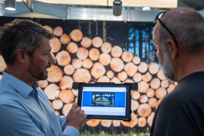
Timber marking is used to uniquely identify logs and timber assortments throughout the entire value chain—from harvesting in the forest to further processing at the sawmill. Marking is often done directly in the stand or after felling using weather- and UV-resistant marking paints, marking sprays, or special forestry markers. In addition, numbered tags, barcode- or RFID-based systems are used to uniquely record and digitally track individual logs. Such identification systems can also be partially integrated into sorting and processing operations, supporting efficient timber logistics and the traceability of timber origin.
Roundwood measurement, volume and weight determination
A three-dimensional representation of a log that is as accurate as possible helps maximize both the quantity and quality of the wood during peeling. To achieve this, the log profile is measured using high-performance 3D scanners to identify irregularities and contour defects, thereby enabling the logs to be classified. This can be done either manually or digitally, with the latter offering significant time savings. Logs placed on vehicles are photographed from all angles using a digital camera, a process that works even with irregularly stacked bundles or in difficult lighting conditions. A 3D view is calculated from the captured data, and a measurement report is generated.